Bristol – Home 2021, part 5

A Day Out Round Studland

Today was another staying in one place sort of day. I had a couple of possible routes planned, to choose depending on how I was feeling. To be frank, I wasn’t feeling like a day of Dorset hills – yesterday had been long, and the next two days were also planned to be long. So I looked at the map and decided on an even shorter day of local sightseeing.

First, I meandered through Godlingston Heath, stopping for photos of peaty streams and sandy paths.

Then, to the little shop in Studland, to replenish my food supply. Fortified with crisps, one hill seemed like a reasonable prospect. So I set off up Ballard Down. There was a fair stream of people walking down to Old Harry Rocks, which I joined. Part freewheeling, part walking to avoid being anti-social.

It was quite busy there, but enough space to go round. I paused for photos and a snack before heading off along a hill-avoiding track into Studland. The village now seemed really quite busy so I headed north back to the quieter heathland. A mix of road and track got me to the ferry, where I turned back and did some more exploring in the heath – which included some interestingly swampy woodland.

I pushed on as far as the beach. I hadn’t brought my trunks with me, but there’s a section of beach for those that have forgotten their trunks. However, collective opinion was that it was a bit chilly for that sort of thing and everyone was fully clothed. In any case, all this sand didn’t seem so good for my gears so I headed back inland.

It was into the afternoon now, so I headed back to my pod. A shower, change and bite to eat later I then headed back to Studland – this time on foot. The pub there wasn’t showing the football, so was pretty sparsely occupied and social distancing in the marquee was easy.

I walked back a slightly different route, via Aggkestone Rock, over the empty heath, as evening arrived. The 4G there was sketchy, but I looked in on Twitter and got an early night. The day had been easy: a 26km, 350m climb ride in just under 5 hours; and 14km, 170m climb of walking to the pub and back.

Bristol – Home 2021, part 4

Bulford – Ower (near Studland)

Today was going to be a longer day of riding – not feat of endurance long, but with some places to stop and explore along the way it was going to be a full day’s ride. The forecast was for rain, clearing up later – but not late enough to be avoided. In any case, the peacocks woke me up early.

I was fed, packed and ready to go at 8. I thanked my hosts and set off. The first section was retracing my arrival through Amesbury. This time I found the bridleway immediately out of Bulford, rather than taking the foodpath. The footpath would have been better – the bridleway being first overgrown and then a little used field margin.

Then, through Amesbury – seeing the infamous Friar Tuck cafe, though far too early to justify a stop! The Dunkirk Social Club had union flags better suited to a much taller pole – embracing the current fashion for performative patriotism in a way that had passers by bowing. Then a rolling lane, the titter inducing Wilsford Cum Lake, and settling into the damp riding.

Getting up the climb from Woodford without a stop reassured me that my legs were working. The road down to Wilton had roadworks with alternating direction traffic lights, which gave me another test. There were more climbs getting out of Wilton, but with less traffic and pleasant tree lined lanes.

A resumption of traffic and a quitling pass (obvious risks, zero benefit) near Bishopstone had me seeking a smaller back lane for a while. Then soon onto a civilized byway from Bowerchalke through a wood and between fields. Even in the rain, this was being a good day out.

The next section of bridleway, along Ackling Dyke, started well – a wide forest path then a cautious roll along wet grass. It then turned into a kilometer or so of close undergrowth, with enough nettles and thorns to make my legs tingle.

Approaching Knowlton I stopped for 5 minutes while a farmer’s cows crossed the road. Then took a break to explore Knowlton ring and the ruined church there. There were a few people about, but not enough to feel like a crowd. One man stopped for a chat, giving me a quick guide to local ley lines and other ancient sites in the area. There was also a small grove, which he informed me is used by the local white druids, and was festooned with ribbons. He talked about the beliefs in a slightly distant way, but I couldn’t help but think he appreciated them more deeply.

The church bore some carved graffiti, which could be imagined as having a significance beyond marking a visit, and nature certainly felt welcome here. The grove and walking slowly round the ring made me glad I’d come here.

Carrying on, there was a quite formal tree lined road going into Moor Critchel. Then I found a nice bench for a snack. The roads were starting to steam as the rain had been replaced by sun, so I packed my jacket away too. A little gap in the hedge revealed a path across fields – not my route, but it gave a nice doorway off the road sort of feel.

There was more off-road to get to Badbury Rings. Dirt under-wheel felt like an appropriate way to arrive. A beautiful space: expansive views with looming clouds and a hovering hawk, more flowers and insects and more trees.

A few people said hello, though one boy looked quite worried – I’m not sure whether it was me in general (wet, scratched and grass-flecked), or the idea of being close enough to both look at the same information post marking out the surrounding places. I moved on and left him to it.

A descent and the sun going in had a long sleeve on for a while in the next run of lanes. I felt like I was getting closer now, though not quite done yet. The next stretch was on forestry tracks through Wareham Forest. The geology changed – from chalky downland to sand and peat. There had been a large fire last year, and there were still sections of burnt trees and open ground. The tracks through the forest wound around, making it hard to keep a sense of direction and certainly giving the impression that this wasn’t the shortest path – though it was when I planned it! It was nice to take in easy though, mixing with mountain bikers out for a blast, families and walkers – one couple taking an interest in my trip as I put on a waterproof for a shower.

Through Wareham, Komoot had me taking alleys through housing, which felt a bit weird and wasn’t always easy to follow. Then some cycle path, other the railway, and a pause to buy some supper before the shops closed.

I picked up another cycle route across the heath, mixing lane and sandy tracks. My chain was now a bit more audible, rain and distance having removed the lubrication. I misjudged the approach to a gate as a lady with a dog held it open but standing in the place I’d normally have ridden to open it myself – and picked up a scratch from my chainring.

Soon enough I arrived at my “pod”. It was pretty basic – as advertised – more like camping than glamping. There was a compost toilet, a shower in a farm shed, more chickens running about – but also Swallows nesting and many birds in the trees. I took a walk at sunset, saw some nodding donkeys at the local oil works and met no-one (though a party with music was happening by the bay). Not uninhabited, but far from the bustle.

My bed wasn’t the most comfy, but a good day out had me sleeping well all the same. My GPS said I’d covered 100km and 1200m of climb in just under 10 hours – of which just over 7 hours were “moving”. I suspect some of my walking around ancient places and pushing through undergrowth didn’t count as cycling in the mind of the Garmin.

Bristol – Home 2021, part 3

Bulford Day Out – Standing Stones and Red Flags

Today was always planned as an easier day, a loop without the panniers.

I woke early – daylight peeking in, wanting lower light and fewer people for the first part, and peacocks next door. By 7:45 I was on my way.

First a rural curve to avoid main roads at rush hour, then soon a track and Woodhenge. David St. Hubbins came to mind, but I passed a little while taking pictures with the shadows and edge-lit clouds – and avoiding the camper van just beyond. My new wide-angle lens being just the thing to make drama out of the knee-high representation of the long-gone wood.

On towards Stonehenge. I changed my plan a little as the view and the tracks on the ground seduced me – a walk down the Cursus through a field, instead of a ride through an army base with less view. Looking down amongst the still-dewy grass there were webs everywhere and a few mushrooms starting to show. Looking out there was a big rolling view, with Stonehenge clear but distant and the various mounds of the wider landscape around.

At the end of the field I exchanged greetings with the man parked up next to the gate, and rode up the line of vans, buses and campers to a view near the A303. I paused to let someone turn, and was rewarded with a friendly chat about whether my bike was human powered.

English Heritage were running pre-booked visits only, so I was turned away at the bus drop-off – but pointed towards a gate and path parallel to the boundary – and so almost as close as a paying visitor. This early in the day there were just a handful of security / guides there – the tickets not on sale yet – and they were mostly out of sight. It did occur to me that had I booked, I probably wouldn’t be here without anyone else around. A friendly family asked how I got where I was, from the field behind me – but I basically had the place to myself.

I double backed to the track, and west at the junction. I wandered into Fargo Plantation and saw some of the mounds, then carried on. The visitors were starting to walk towards Stonehenge by now. I chatted to a member of staff, who said there were some tickets available if I wanted. However, it was getting busy and I quite fancied getting on to Salisbury plain and so didn’t stop for now.

A quick bit of fairly quiet main road took me to quieter road beside well-fenced barracks. However, as I got to the byways it turned out that red flags had a chunk of my planned route closed. I’d checked the online diary while planning, but must have misunderstood the extent of what was off-limits (assuming the army wasn’t doing something spur of the moment). The policeman was nice about it, and took the time to look at what I had been hoping to ride. He suggested one alternative, but that involved rather more A-road than I fancied – so I opted for a safe route to the east. I set off into the plain where I went a fair way without seeing anyone on wide, tank-ribbed, gravel tracks.

My next junction was beside another red flag, and I decided to err on the side of caution and less danger and avoid the turn off. Rather than a longer gravel ride I wondered whether a ride back to the stones and taking the tour was an option.

I came down the west side of Larkhill, past big hangers and armored vehicles. However, at the end “The Packway” looked positively hostile after the peace of the byways – fast trucks swishing the verges in both directions. So I headed back onto the plain, and followed the byways round north of the base and then further east. One police car passed with a cloud of dust, but I was mostly alone with a big view.

After coming to a road, I paused to check that the route through was OK with two other cyclists. I crossed a river on a bridge with warnings about one vehicle at a time. A bit further on I saw a group of armored vehicles. I’d left my OS behind, and so without a reference to rights of way I turned and took a quiet lane back to Bulford.

Today was about half the distance I’d planned, at 30km and 330m of climb in a leisurely 3 hours 45 – including a lot of stopping for pictures and walking sections. I was washed and done in time for lunch – which was a ploughman’s in a quiet (there were two other customers) pub garden. I pondered heading back to Stonehenge, but decided that in the heat of the afternoon amongst a crowd I wasn’t going to improve much on the pictures or experience I had earlier. So, I took a walk around the grounds where I was staying – they keep a range of poultry and have created a great space for wildlife, and then read some book and generally took it easy before what promised to be a long next day.

Bristol – Home 2021, part 1

Home – Bristol – Bath

This was the start of a week away. The plan being a low-contact, Covid avoiding tour, staying in England. I had my Sonder Camino loaded and ready to go.

I got out of the house in good time, to Lewes station. Where my train was cancelled, due to too many being broken. The train timetable app wasn’t advising a dash to Brighton, so I stayed put. I’ve used Southern trains often enough to anticipate a cancellation and a half hour wait left making my connection tight but doable.

I did get to London, on a train that wasn’t packed but with two trains of people wasn’t empty either. Masks all round though. The ride along the edge of Hyde Park to Paddington was fairly brisk, although I was obliged to wait a minute for the Queen’s horses and men to trot past and several traffic lights on the new (to me) cycle route. I had a quick chat to another cyclist at one set of lights, and offered him to go ahead, on account of being rather less laden.

My carriage wasn’t at the far end of the train, and my bike’s reservation in the next carriage. The space was empty, though I wasn’t the only cyclist getting on. The train pulled out as I was hanging it up, and I relaxed – the timetabled part of the trip was working. I’d treated myself to a seat in first class, which was pleasantly empty.

My phone got a charge and a podcast passed the time to Bristol. Here I failed to stop for lunch, wrongly assuming that there’d be somewhere just outside the ticket barriers that was more interesting than platform food. Then, after a small loop as I missed a turn in some roadworks, I was heading away from the center. I rode along an on-brand graffitied, but rideable, cycle path beside the river. In a park I paused to put on sun cream and have a snack. Then wound my way through a Sustrans suburban route to an ex-railway cycle path.

This turned into a lane, climbing steadily, and the first spots of rain appeared. Soon enough I’d paused under a tree for a waterproof, as it was neither as light or brief as I’d first hoped. A little further on I passed someone with their second puncture of the day who was calling for a drier exit.

Around the top of the hill another cyclist offered “it’s like a river down there” as she passed in the opposite direction. I contemplated overshoes, but my feet were soaking already! Then down, to Chew Magna, the road running like a river – as promised. An empty can floating past. My first stop was to visit a friend from work, who had recently moved here. She had a towel ready, and we caught up over a mug of Early Grey.

On setting off again I had a couple of back and forths, trying the wrong hill out of town, before finding my turn. Sandy Lane was indeed sandy, and gave me my first brief push – it takes more tyre than I’m using to do uphill sand. Then some lovely green lanes rolled me along to Stanton Drew. I do like a an ancient place, and I spent a while taking a leisurely walk around with my camera. I had a the field to myself, which was relaxing and let me take in details, experiencing them as a calm space.

By the time I set off again it was gone 4:30, but the next stretch was quiet, rural and rolling – some effort required but enjoyable. Under a big viaduct at Pensford, and over a bigger lump coming into Pensford. Eventually I reached the slightly downhill and traffic free (except all the other cyclists and runners) Bristol – Bath cycle route.

This, as you’d expect, took me into Bath – and with minimal faffing. Somehow I’d put the wrong Travelodge into Komoot, but the right one was all downhill and only took one loop around the theater to find. The bike in the room worked fine, and let me get things dried out and repacked easily.

50km with 600m of climb covered in 5 hours. Which felt like a respectable first day, especially since half the day was spent on the train.

It was an England match tonight, so my plan for supper was to avoid the crowds. The first restaurant I tried (a nice looking Breton, but not pancakes, place) was closing due to lack of trade, but Cafe Rouge provided the right mix of bread, wine, salad and pudding to set me up – and feel like a treat. Especially as I was one of about 5 customers. Football and people avoided, I slept well.

Oban – Arran (2019, Part 6 – Lochranza to Brodick and then Home)

It rained in the night, falling onto the skylight above my bed, and woke up early – but to a fine day. It wasn’t the best night’s sleep, but it wasn’t going to be a particularly long day. I got hostel breakfast as soon as it was out – along with other cyclists keen to be on the road – several of us to catch the ferry. My train from Glasgow wasn’t until lunchtime, but there was one sensible ferry to catch (and one earlier).

The map showed a 200m hill to start my day – the highest of the trip. The gradient was OK, despite the panniers, but it went on for 5km. I made one stop for a photo on the way up, just as the sea at Lochranza was going behind the land – and another on the way down when the view was too good not to stop for.

The 200m back down the hill was fun, swooping towards the sea, one levelling out then down again. Then the road hugged the coast. A town, a little woodland, land to one side the sea the other. A rock stacked on another rock on the shore. A view across the bay. A family by the water’s edge. No longer downhill but the road was easy and I had the energy to ride a bit faster. I could see the previous day’s ferry in the port, which made me wonder if I could catch it – but the port was a way round the bay and the answer was clearly “no”.

A short ride through the town, the bulk of Beinn Tarsuinn and Goat Fell always present. And then I was there, the riding done. A ticket for the ferry bought, in plenty of time to meet it – but not really enough to wander off and explore. So I took a short walk, and then went to queue.

The ferry swung into the dock, visibly leaning. Then let out its cargo, including a MINI pulling a caravan. A couple and myself the only cyclists – the others at the hostel having been on the earlier ferry. Up to the deck to look around and relax – too early for lunch.

The sea was quiet, despite the noise of the ferry. I took a few last photos as Arran receded and Ardrossan approached. The texture of a sea was pleasing, with the dark strip of land giving it a boundary. The clouds that had definition today, and another ferry passed for a while putting something into the open scene.

20190527_115319

And then off the ferry, wheeling to the train station. The couple I’d joined with chatting about business ideas as the towns rolled by. Then onto my train south, the train with a dangly bike space in with the conductor. I found my seat in the next carriage, got some food, and watched Scotland turn into England. I read a little, listed to a podcast, checked Twitter, dozed.

Euston to St. Pancras was easy, apparently someone had won at football but I found my way through them. Another change at Croydon and soon enough I was back in Lewes. A short ride home, and back to the family.

Ferries taken: 1, trains taken: 4

Distance ridden: 24km with 280m of climb.

part-5-map

part-5-elevation

My trip was a success – I’d ridden from Oban to Brodick, with an afternoon out on Mull. 288km recorded, probably 300km with the handful of 1 and 2km connections I hadn’t switched the GPS on for. I’d climbed hills, moved through changing landscapes and ridden by the sea. The roads had included long stretches of quiet single lane roads, some green lane, and a couple of stretches of rough track. I had seen (and heard) wildlife that isn’t found at home, explored ancient places. There had been great beauty in the mountains, the forests, peaty burns, flowers that surprised and big open spaces with quiet. I’d met nice people and eaten good food.

80 and 90km days had been long enough and the hills had made me feel I was working at times, but the ride had been a good match to my fitness and bike – and left plenty of time to stop and look, take photos rather than watching the clock and treating it principally as a physical challenge. I’d packed the things I’d needed, not left out anything I really wished for, and had little that returned home unused.

The mix of road and track; riding with time to stop and see is something I enjoy. I feel that both Mull and Arran have plenty left to return to, and there is plenty more of Scotland that would enable a similar tour through different places.

veloviewer-wheel

Oban – Arran (2019, Part 5 – Tarbert to Lochranza)

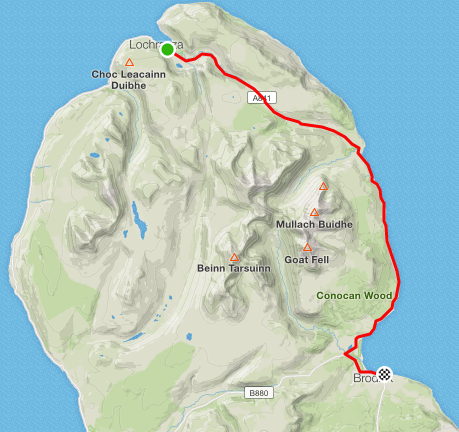
Monday 26th May 2019. It was still raining outside when I woke, but my things were mostly dry after the previous day’s rain. Today’s plan was in two parts: first, get to Arran; second ride a loop round the north part of the island. However I was booked into the youth hostel in Lochranza, and the possibility that a long ride in the pouring rain wasn’t going to be that much fun entered my head.

Over breakfast I met the others staying at the B&B. One couple was cycling north, reversing my previous day’s route, while I would cover some of their’s. We chatted about routes, and with the others who were also touring with engines; and then about past tours … none of us in any great hurry to leave the nice warm house and head out.

Eventually I said goodbye, packed my things, loaded the bike up. The earlier rain had eased off, but the forecast was for more.

I rounded the corner facing the harbour, where the yachts were still moored but boats were moving large floats out to mark the course.

It was bank holiday, and the road was quiet – which was a relief. The next section was on A road. Not like a “green” road in the south east, but still national speed limit and busier than my last few days.

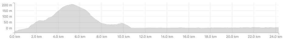
9km later, nothing bad had happened and I turned left after the ferry terminal for Islay, and onto a small road again. This went up, pretty steep without much break for quite a while. Until I found a couple in a camper, pulled over and looking at the engine. I asked if they were all OK, as if my bike repair kit was going to help. Apparently it had made a worrying noise, but seemed to be OK when they came past a little while later.

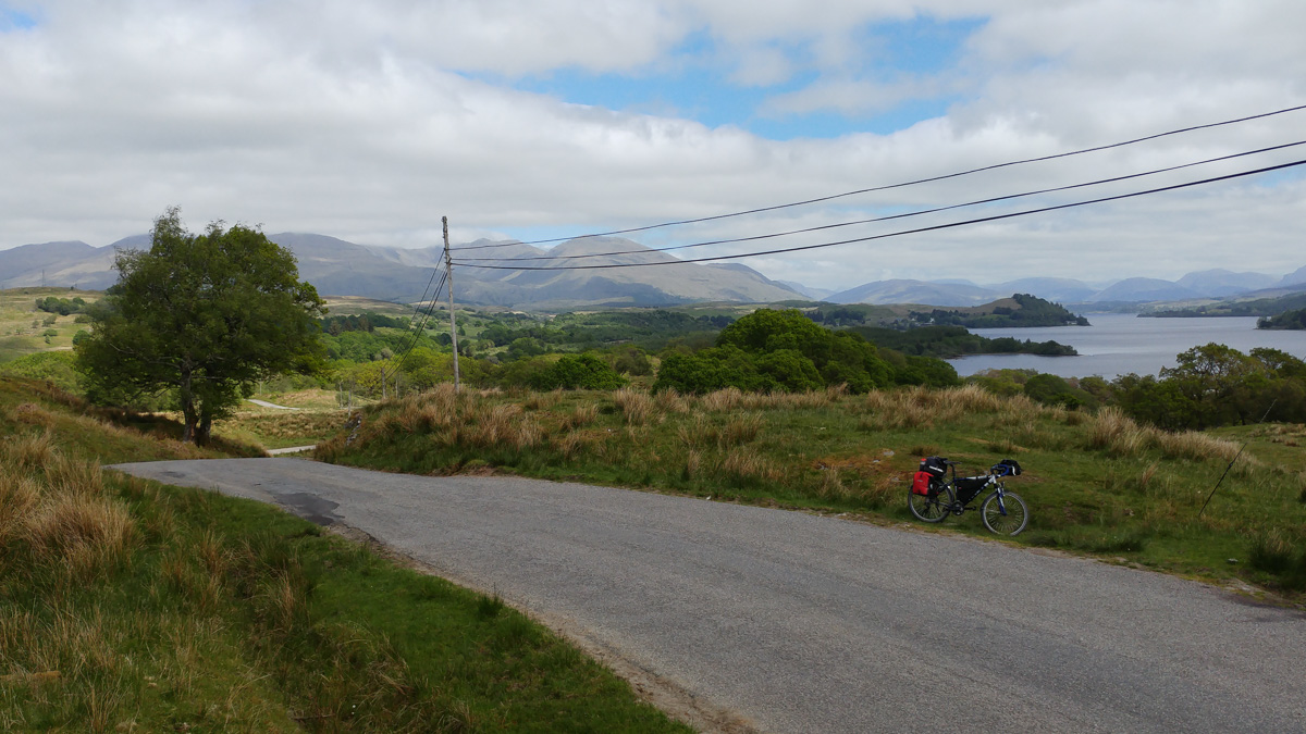
At the top I could see a good distance, despite it being wet, including a wind farm. I paused for photos, but not so often as I had a ferry to catch – and didn’t fancy a long wait for the next one.

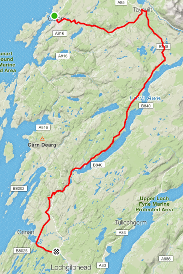
The road then turned down, into a long, sweeping descent. A little braking to keep in controlled in the wet, and to let cars by on the single track; and a little pedalling for a rise, but in the end I was down at the ferry terminal in good time.

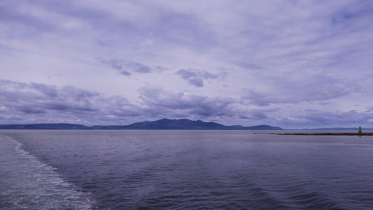
I joined the walkers in a shelter, and waited for the ferry to arrive. It is only a short crossing from Claonaig. The ferry was correspondingly basic, with just deck space. The wind had got up now and while the sea wasn’t rough there was a bit more wave than I’d seen so far this trip.

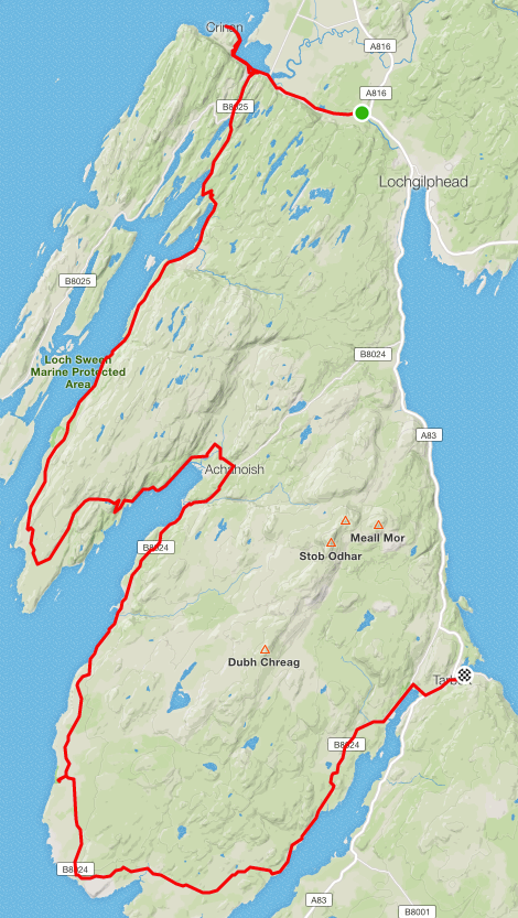
Off the ferry, I rode up to the youth hostel to drop off my panniers – my plan being much like for Mull, to make the ride easier by dropping off the extra weight. The hostel wasn’t open, but had somewhere to put things. I decided that the loop was worth a go – so headed back towards the ferry terminal. There I found a sandwich shop, which the cyclists at the B&B had recommended – and indeed provided a tasty and warm blue cheese and chutney sandwich which I ate in the bus shelter.

20190526_115604

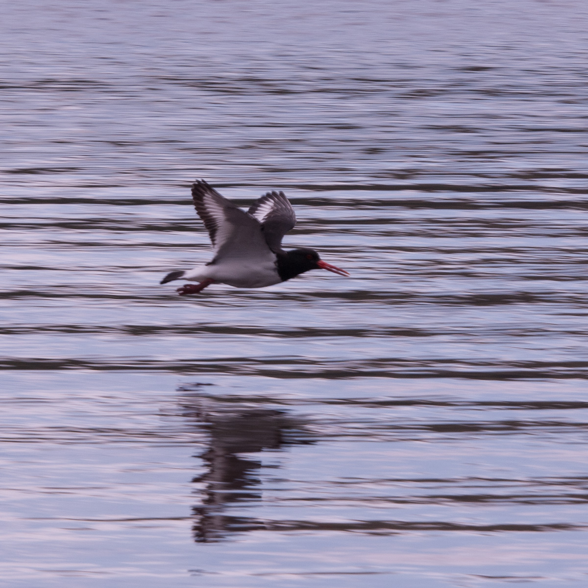
Heading off round the island, anti-clockwise I got about 1km before it felt like a slog – rain being driven by a headwind. An oystercatcher called as I paused, checking my map, realising I had a fair bit more of this before it became a side-wind. Answer: a fair way.

My resolve weakened – the trip round the island would be more fun without the driving rain. There was a castle, a coastline, a craft show and a distillery that could be explored instead. So that’s what I did.

As I turned, it felt like the rain had stopped – it was being blown past me rather than onto glasses any more.

The castle was an interesting ruin. Photogenic crows circled over it. There was a dungeon that was deeply dark, and felt quite intimidating even without a door.

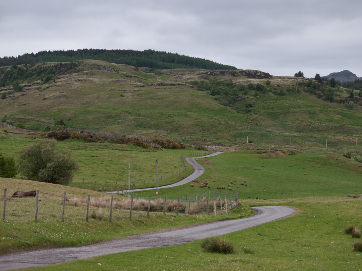
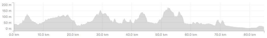
Then I turned off down a side road, that didn’t head to another town. And soon found some red deer grazing on the golf course.

_1110775

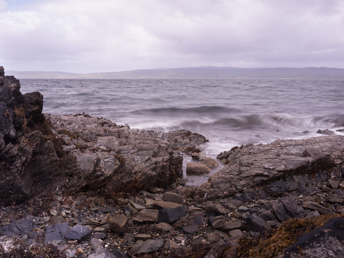
There was also a shaded stream, with a little fall, reflections. The a little further on the road ran by the shore – with dried seaweed contrasting with white stones and yellow gorse.

The road turned into a track, then a path. I paused to spend some time exploring one little section of the rocks, flowers and waves. Making pictures of details, blurring the waves and relaxing into observing more closely.

_1110840

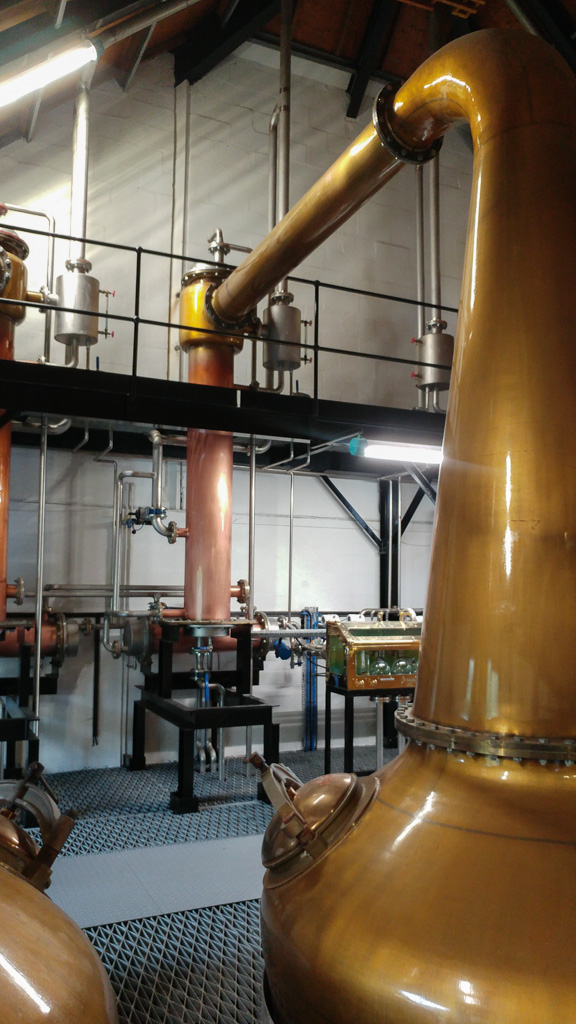
Then, I turned and headed back the way I had come. The community centre had an art exhibition, and I spent some time enjoying locals’ work. Then the final obvious thing to do was visit the Arran distillery. I tied the bike up outside, and saw that I was in good company with several other groups of cyclists coming and going.

We had a dram, watched a video, and took a tour of the facilities. On the way out we saw a golden eagle soaring high over the hill. I’d have bought a bottle, but my panniers were already full.

20190526_154813

Then back to the hostel to check in and clean up. I helped another cyclist get her bar bag off – she had taken the route I’d be planning, and her hands were too cold for fiddly straps.

The next day I had a ferry to catch to connect with a train, so I binned the finished-with toiletries and map print-outs, dried the last damp things and sorted my bags out for the morning.

I went to the one hotel / bar in town that seemed to do supper – quite crowded, but they fitted me in. I finished my meal with a glass of the Côte-Rôtie whisky. Then took a slow walk along the waters edge to take a phone call with some bad news about Phoebe, one of our pets. Then, back to the hostel to remember her.

A sad ending to a day that hadn’t gone quite to plan but had nonetheless taken in a good ride, time with my camera, and exploring this corner of Arran. Along with Mull, I’d happily come back and see more another time.

Ferries taken: 1

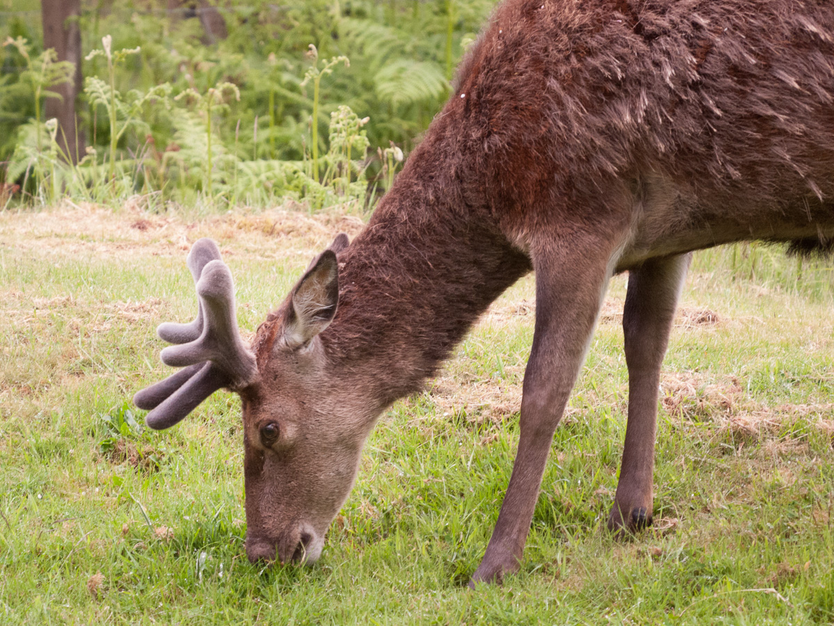
Distance ridden: 34km, 350m climb


Oban – Arran (2019, Part 4 – Cairnbaan to Tarbert)

Saturday 25th May 2019. I’d slept well. The day was drizzly as I had my breakfast. The previous day’s clothes slightly damp, but another night would dry them – and I had fresh for today. A couple of trips up and down from my room and the bike was laden, the bill payed and I was ready. Today was going to be long and a bit of an adventure, leaving not only the Sustrans route but, for 5km, leaving the road for a track to round the Knapdale peninsula.

I put my waterpoof on as I left the hotel, and started back up the towpath towards Crinan. An easy, flat start to warm up fresher legs. There was damper morning light on the view, less defined skies, and mistier horizons than yesterday.

As the canal turned into an outlet to the sea loch, there was a small marina, lighthouse and big still views over flatter country than much of the rest of the day would be.

_1110639

From here I backtracked a little, then turned into the road down Knapdale. Steadily rising, a few cars and wooded. I saw another deer, heard more cuckoos.

The road found its way back towards sea level at Achnamara, gradually becoming quieter, more minor. The land seen across 1 to 2km of sea indistinct – and later the views across to Jura didn’t find land to see.

I found sheep grazing on a bank, the road quiet enough to have grass growing down the middle now.

At some point the rain became steady enough that the waterproof covers went on the rack pack and bar bag. At Castle Sween the view of the caravan park didn’t entice me down the track, but chatted to an American man about his ebike. A runner said hello coming the other way and then turning back.

20190525_120955

Rounding a bend, a few last houses, through a gate and onto the track – two lines of old tarmac. The road had been patched single track, but this was designed for a farmer.

_1110664

Broken enough to be glad of the bigger tyres, not so wild as to feel unsafe. A couple of steeper downhills got walked, but the rest was rideable. I pushed the bike past some cattle, saw some walkers in the distance and then felt alone in the wild. This was a high point in the adventure of my tour, and I’m really glad I went this way, had time in this quiet, wild space.

The track climbs through low trees, falls to a cattle-grid bridge without rails, climbs again opening out onto open country – a small loch and hills across the valley. Past those and the sea becomes visible and the track falls back down to a road.

The road found its way to the edge of Loch Caolisport. There I met a couple on mountain bikes. We stopped and chatted about the route. They seemed pleased to know the way wasn’t too wild and that we both used at least some Alpkit bags.

Rounding the head of the loch, back onto the Sustrans marked route – a quiet B road. I’m marginally more inland now, but the rain is getting stronger and it doesn’t feel any more sheltered. The camera starts to come out let, because it is getting wet. I start turning the pages of the map in phone boxes – thankfully still to be found round here. The first had a decorated stone in.

The road rolls, wetly on. Past a fish farm. Sparsely populated, though there’s signs of past inhabitants. A church reduced to its end wall. A roofless house. There were more cuckoos, but in the wet it was quiet – not even many cars.

The weather, distance and rolling road (only rolling, not as hilly as the day before) were taking their toll. Some way further on I saw a sign for a cafe, in a caravan site. I didn’t hesitate. They were friendly, the previous pair of cyclists was just finishing, and soup was very welcome. An older couple on bikes arrived before I left, in full waterproofs and sandals – finding my shorts a surprise – intending to stay.

The soup and warmth had helped, but my things were wet, the day getting on, and I knew Tarbert would be busy with a sailing event. So it was time to push on and cover the remaining 25km. The route continued to roll, over quiet roads by the sea, then inland where they felt more like climbs than rolls. A brief A-road, and then into Tarbert. The longest day of my trip done.

The harbour was full of boats. My B&B host for the night very kind, though nervous of my wet things on his carpet. I had to gently refuse offers of tumble drying cycling clothes. I had a wash, the wet clothes and bag contents laid out to dry all around the room. Then out, where I found the last table in a pub for a meal amongst the sailors. Later, as I laid in bed reading, fireworks started – finishing a wild but damp day with a bang.

No trains or ferries today.

Distance ridden: 92km, 640m of climb.

part-3-map

part-3-elevation


Oban – Arran (2019, Part 3 – Oban to Cairnbaan)

Friday 24th May 2019. Time for my tour to start touring. Todays ride would see me move through different landscapes, carrying my bags, mostly following Sustrans route 78. My planning suggested a hilly day, though not climbing mountains. I had breakfast at the youth hostel, sorted my bags out with the maps for the day in my bar bag, and set off shortly after 9am on a day warm enough to merit suncream.

A short run back through Oban, and then up a long hill. A man walking the other way offered “nearly there!” followed by a “well…” and a wobble of the hand to indicate that I really wasn’t anywhere near the top – but I had the gears and energy to laugh with him. A brief stop to take photos by a loch, then on up and into a rolling landscape with a road snaking through it. A few bushes, trees, sheep, highland cattle and a standing stone gave it variety and in the distance, glimpses of bigger hills with cloud around their tops.

_1110466

I lost the gained height down to Taynuilt, and found the shop – where I lightened my load by just having the right change and got called “Jimmy” by someone that thought Carlisle was foreign.

The route then turns south, following the River Nant. Here we were back into wooded valley, with flowers, ferns, peaty water, a deer vanishing into the undergrowth and mossy rocks that reminded me of the trolls from Frozen.

The road wound and land rose and opened again, moving towards the northern end of Loch Awe. The landscapes of the day so far repeating themselves as it did so.

The next 25km or so roughly followed the edge of Loch Awe, heading South. The edge of a lake ought to be more or less flat, however this was only roughly following and the road rolled with the hills along the edge, picking up 500m of climb in the process.

20190524_130141

I found a group of deciduous trees and bluebells to spend some time playing with camera blur – though they looked good holding it steady too! I also heard more cuckoos and a woodpecker.

_1110545

Later, this section turned into forestry land – big quiet areas of conifer, with occasional gaps to look over the loch. Five motorbikes with sidecars went by going the other way, one with a trailer as well – feathering the brakes a bit gingerly on a downhill.

At the tail end of the loch the road dropped down (at last, this was getting tiring) to run flat near the shore. A spot of scrubby ground and a small island enticed me to stop and get closer to the water. Oystercatchers wheeled overhead calling out.

_1110583

The road then left the water, very briefly on an A road, then I turned off towards Carnassarie Castle. This was a rough track and one of the sections where my riding something closer to a mountain bike made sense. There were now around 4km of track over the moor, past the castle, some standing stones, old walls and then the more modern scenery of a gravel pit.

This then led into a lane, following the valley through Kilmartin Glen – a place with more ancient connections. I paused to go and look at two chambered cairns and a ring of standing stones along the way. These tended to be a bit fenced in, but a gap in the rocks framing down the valley was an interesting view.

By now I was feeling the distance and hills, and time was moving on. The next 6km of road from here was completely flat through the Moine Mhòr, wooded at first then a large expanse of peat marsh. Despite it being a tour, I spent a while in the drops letting the distance pass. At the end of this, I turned onto the Crinan Canal towpath and to my hotel.

My bike stashed with several others in a hotel receiving room, I cleaned up and had a good meal – it had been a good day out, but I felt I’d earned the meal with the hills – and a short walk by the canal after.

No trains or ferries today.

Distance ridden: 85km, 1100m of climb.

part-2-map

part-2-elevation