Bulford – Ower (near Studland)
Today was going to be a longer day of riding – not feat of endurance long, but with some places to stop and explore along the way it was going to be a full day’s ride. The forecast was for rain, clearing up later – but not late enough to be avoided. In any case, the peacocks woke me up early.
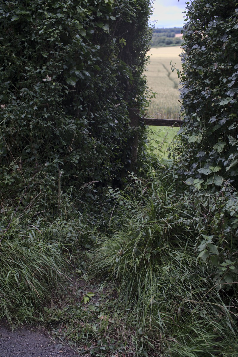
I was fed, packed and ready to go at 8. I thanked my hosts and set off. The first section was retracing my arrival through Amesbury. This time I found the bridleway immediately out of Bulford, rather than taking the foodpath. The footpath would have been better – the bridleway being first overgrown and then a little used field margin.
Then, through Amesbury – seeing the infamous Friar Tuck cafe, though far too early to justify a stop! The Dunkirk Social Club had union flags better suited to a much taller pole – embracing the current fashion for performative patriotism in a way that had passers by bowing. Then a rolling lane, the titter inducing Wilsford Cum Lake, and settling into the damp riding.
Getting up the climb from Woodford without a stop reassured me that my legs were working. The road down to Wilton had roadworks with alternating direction traffic lights, which gave me another test. There were more climbs getting out of Wilton, but with less traffic and pleasant tree lined lanes.
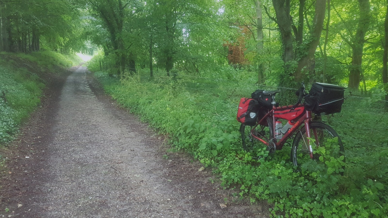
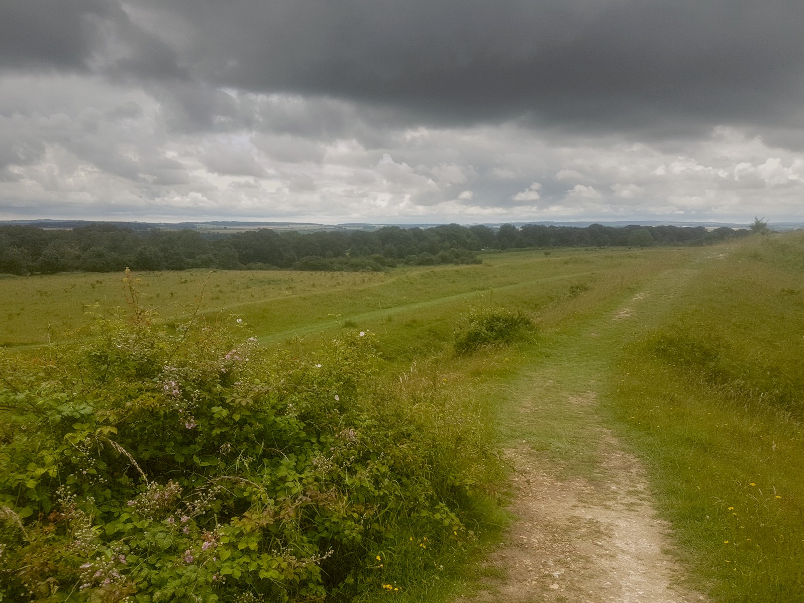
A resumption of traffic and a quitling pass (obvious risks, zero benefit) near Bishopstone had me seeking a smaller back lane for a while. Then soon onto a civilized byway from Bowerchalke through a wood and between fields. Even in the rain, this was being a good day out.
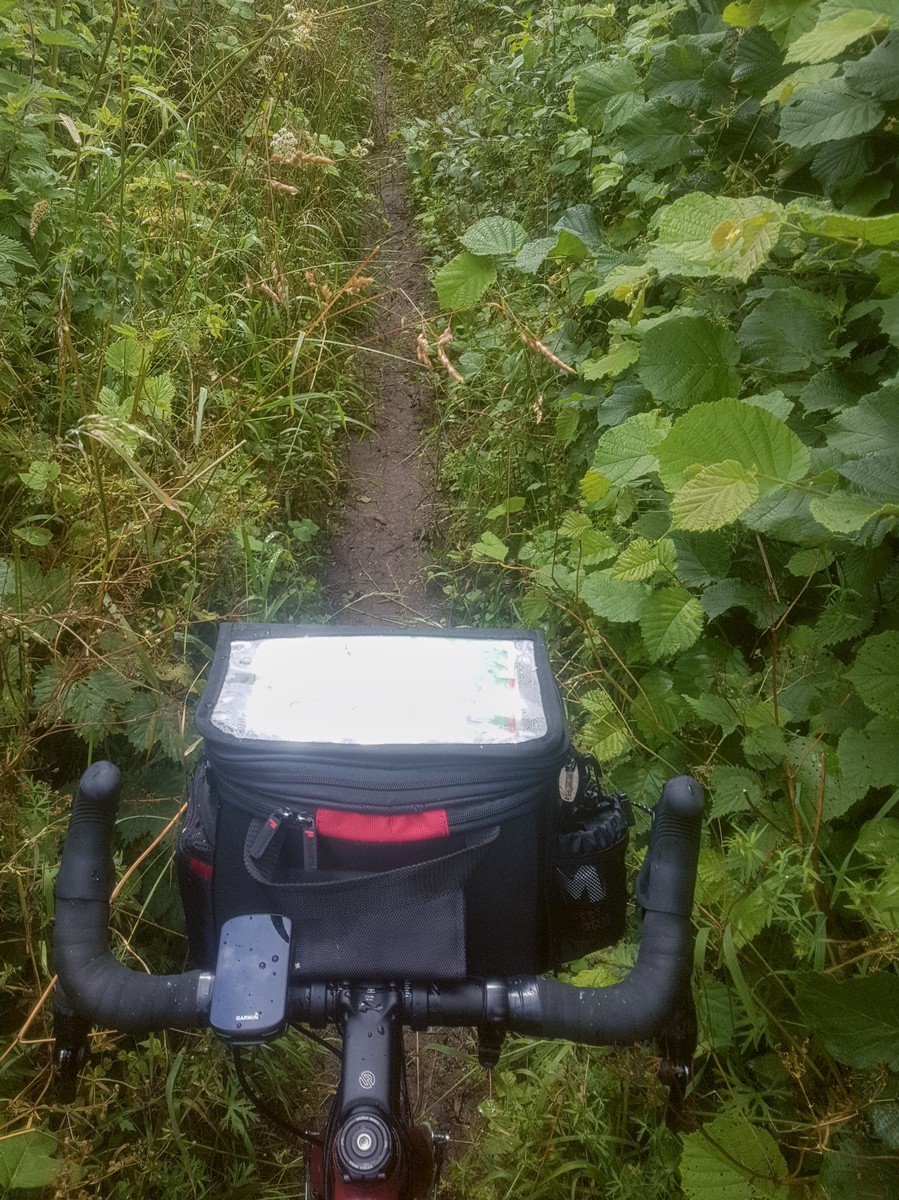
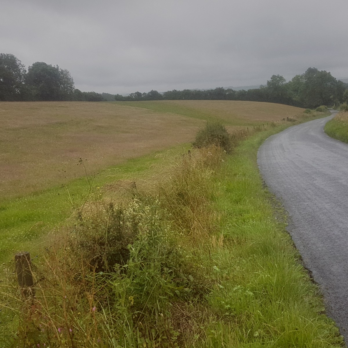
The next section of bridleway, along Ackling Dyke, started well – a wide forest path then a cautious roll along wet grass. It then turned into a kilometer or so of close undergrowth, with enough nettles and thorns to make my legs tingle.
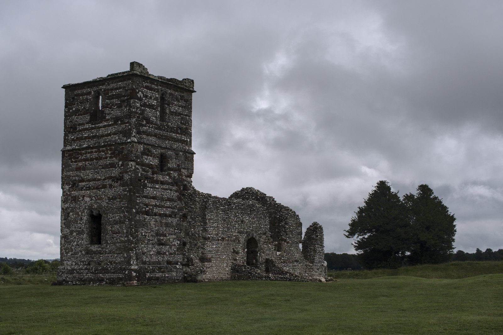
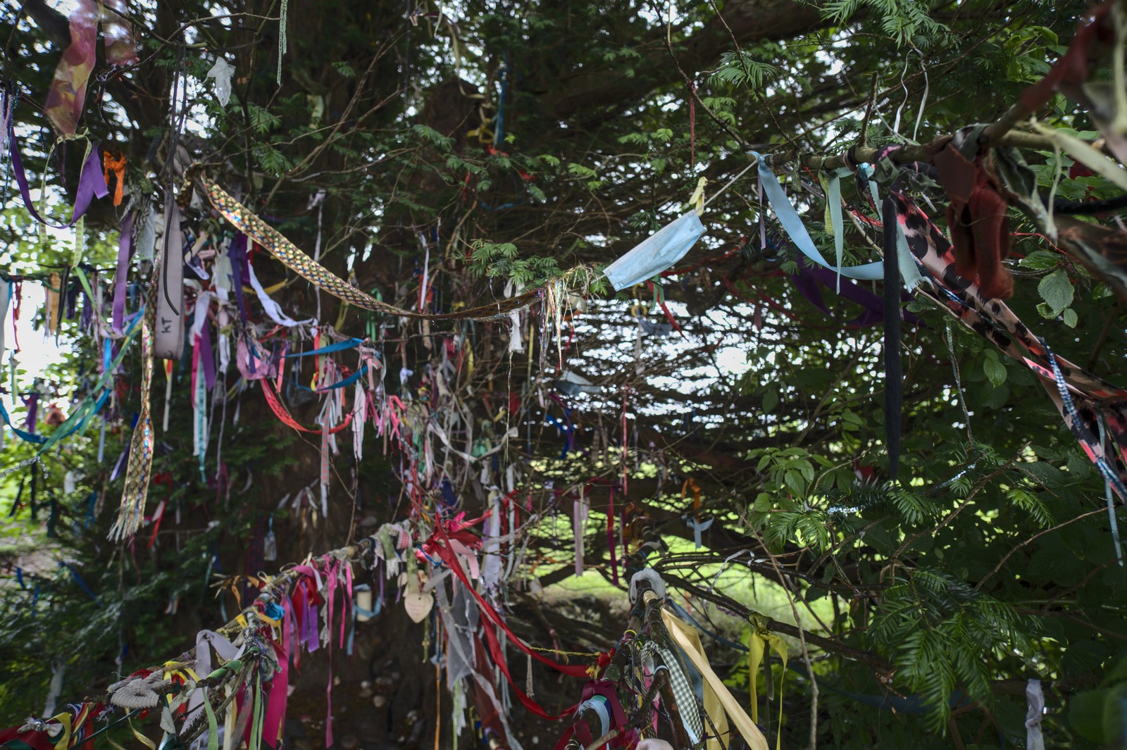
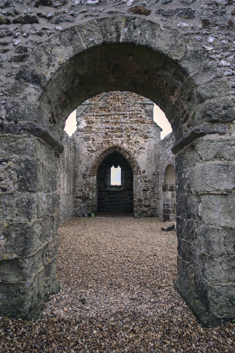
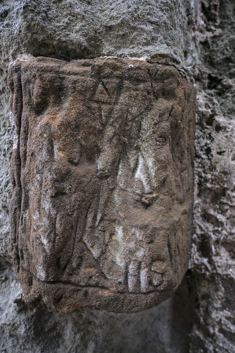
Approaching Knowlton I stopped for 5 minutes while a farmer’s cows crossed the road. Then took a break to explore Knowlton ring and the ruined church there. There were a few people about, but not enough to feel like a crowd. One man stopped for a chat, giving me a quick guide to local ley lines and other ancient sites in the area. There was also a small grove, which he informed me is used by the local white druids, and was festooned with ribbons. He talked about the beliefs in a slightly distant way, but I couldn’t help but think he appreciated them more deeply.
The church bore some carved graffiti, which could be imagined as having a significance beyond marking a visit, and nature certainly felt welcome here. The grove and walking slowly round the ring made me glad I’d come here.
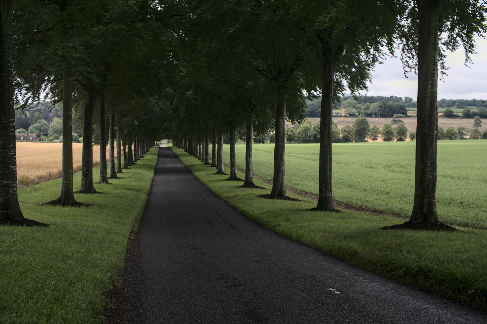
Carrying on, there was a quite formal tree lined road going into Moor Critchel. Then I found a nice bench for a snack. The roads were starting to steam as the rain had been replaced by sun, so I packed my jacket away too. A little gap in the hedge revealed a path across fields – not my route, but it gave a nice doorway off the road sort of feel.
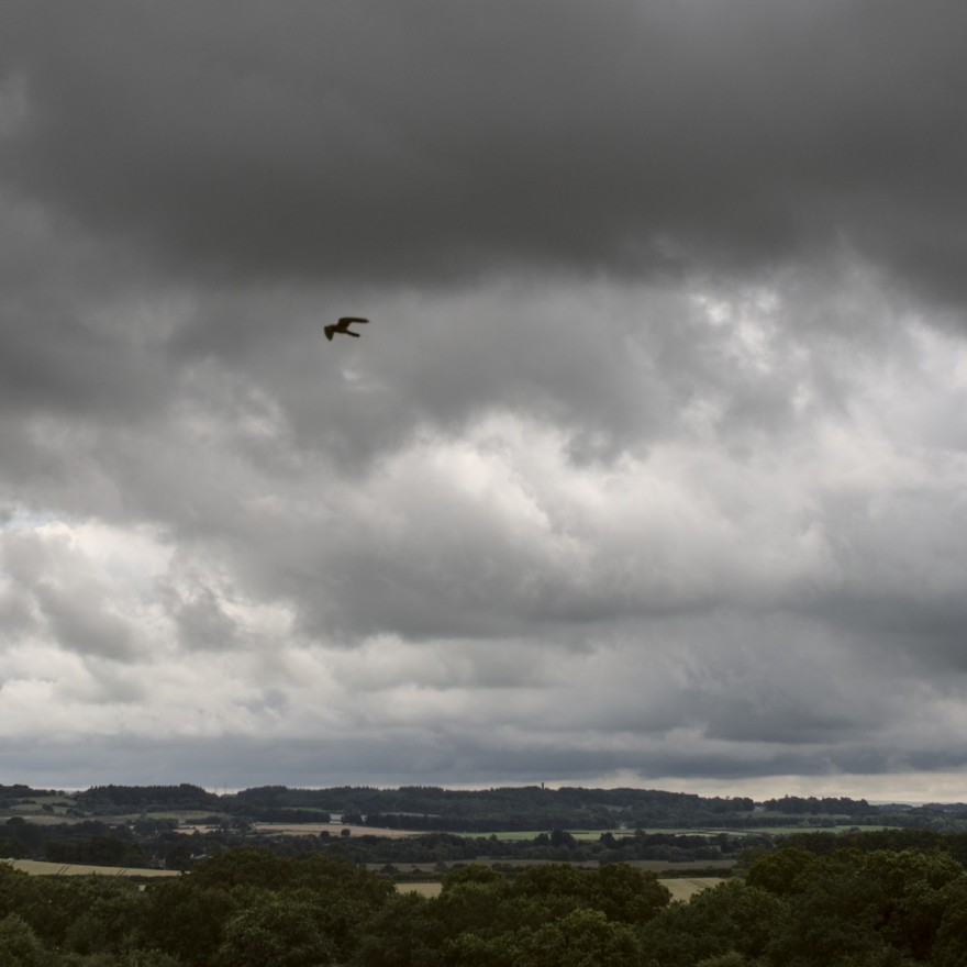
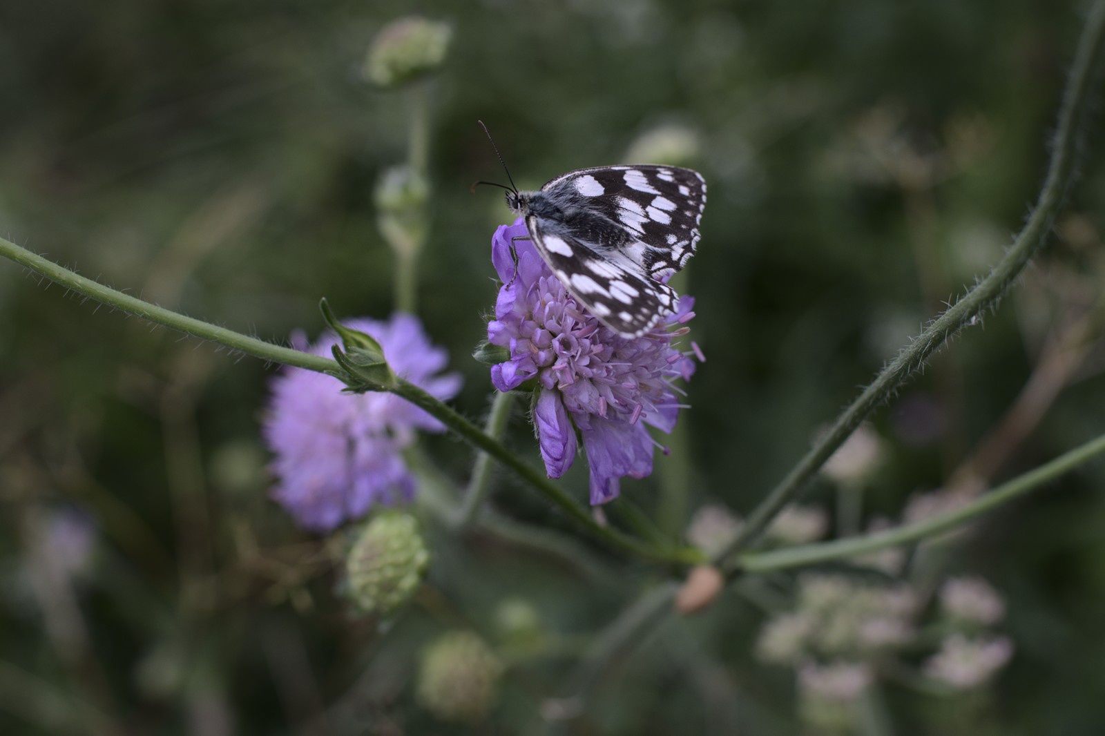
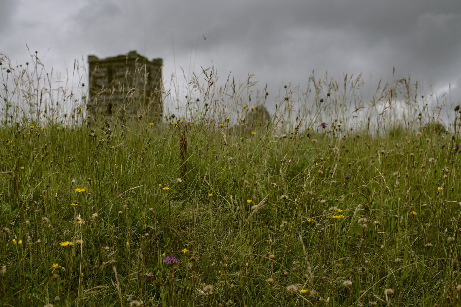
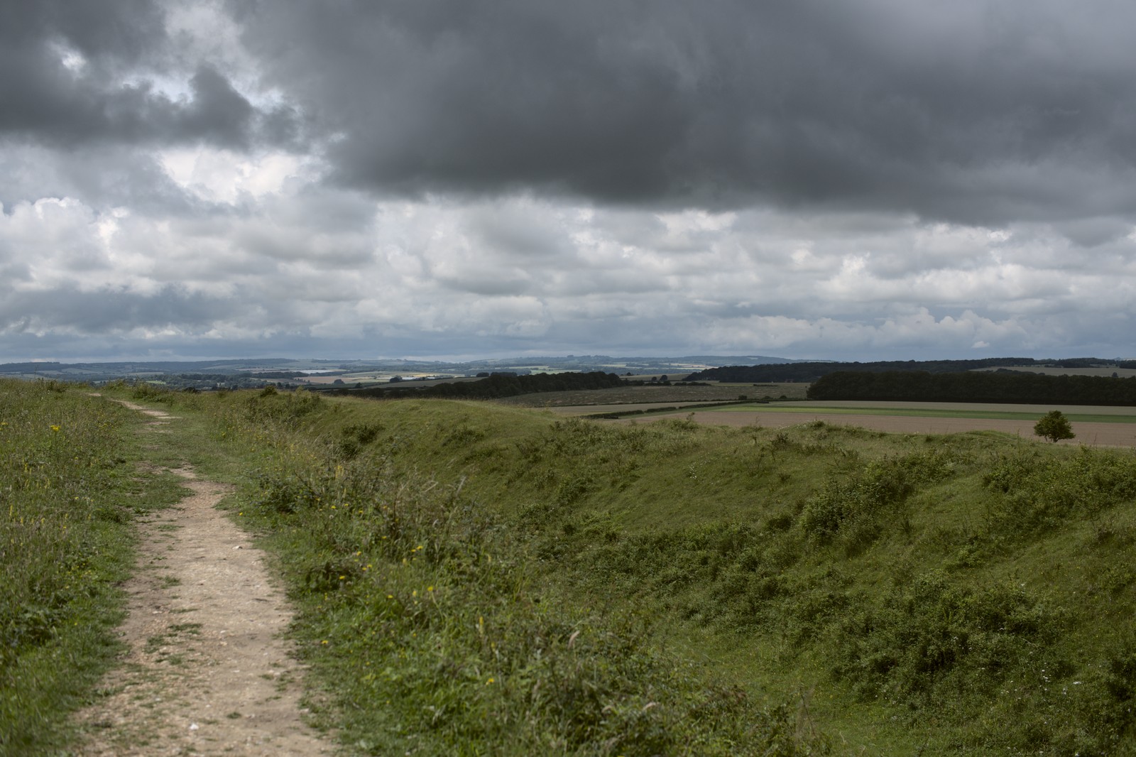
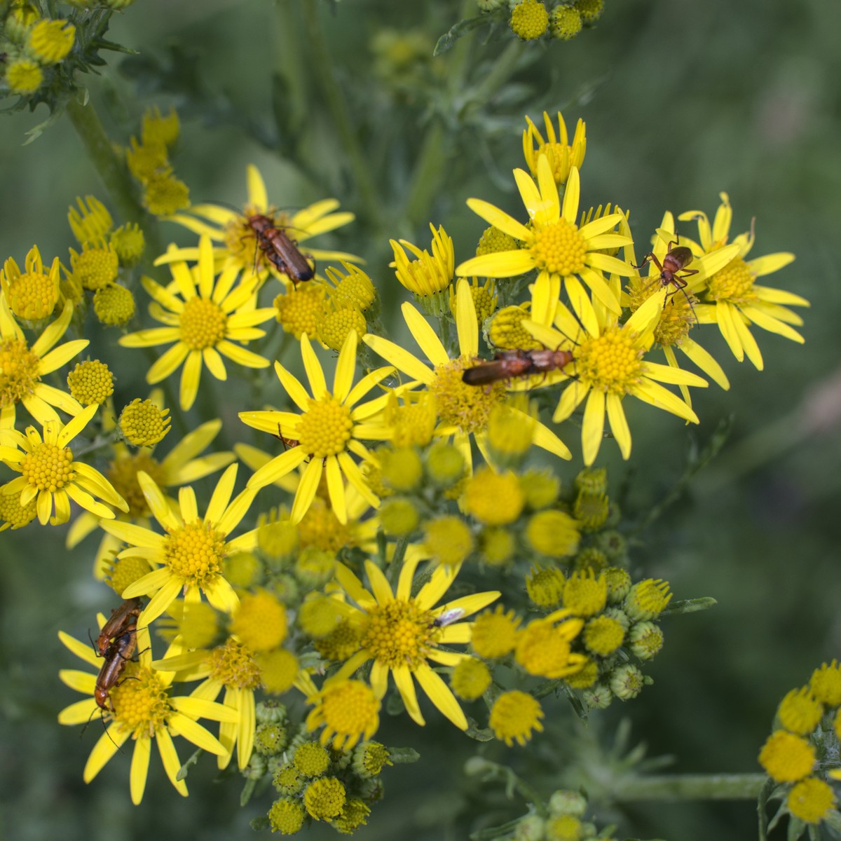
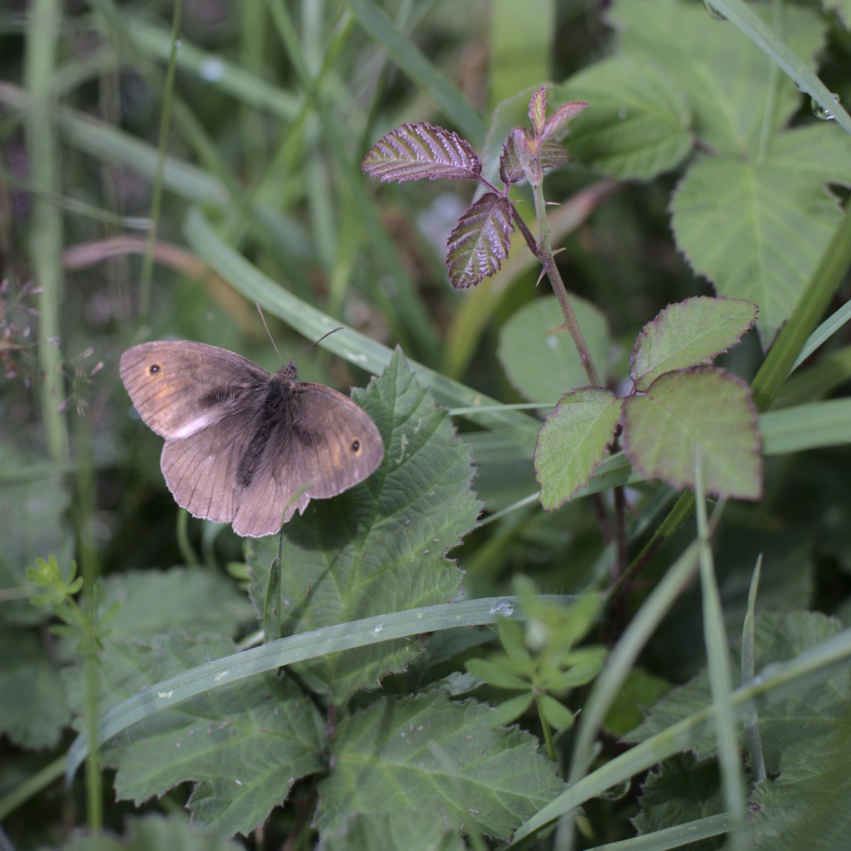
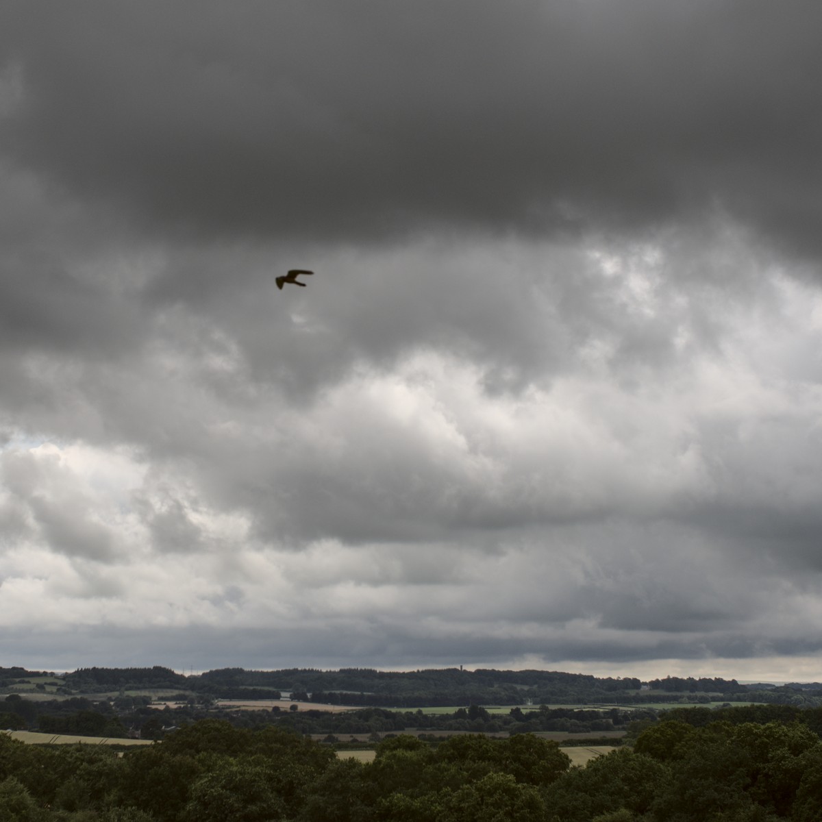
There was more off-road to get to Badbury Rings. Dirt under-wheel felt like an appropriate way to arrive. A beautiful space: expansive views with looming clouds and a hovering hawk, more flowers and insects and more trees.
A few people said hello, though one boy looked quite worried – I’m not sure whether it was me in general (wet, scratched and grass-flecked), or the idea of being close enough to both look at the same information post marking out the surrounding places. I moved on and left him to it.
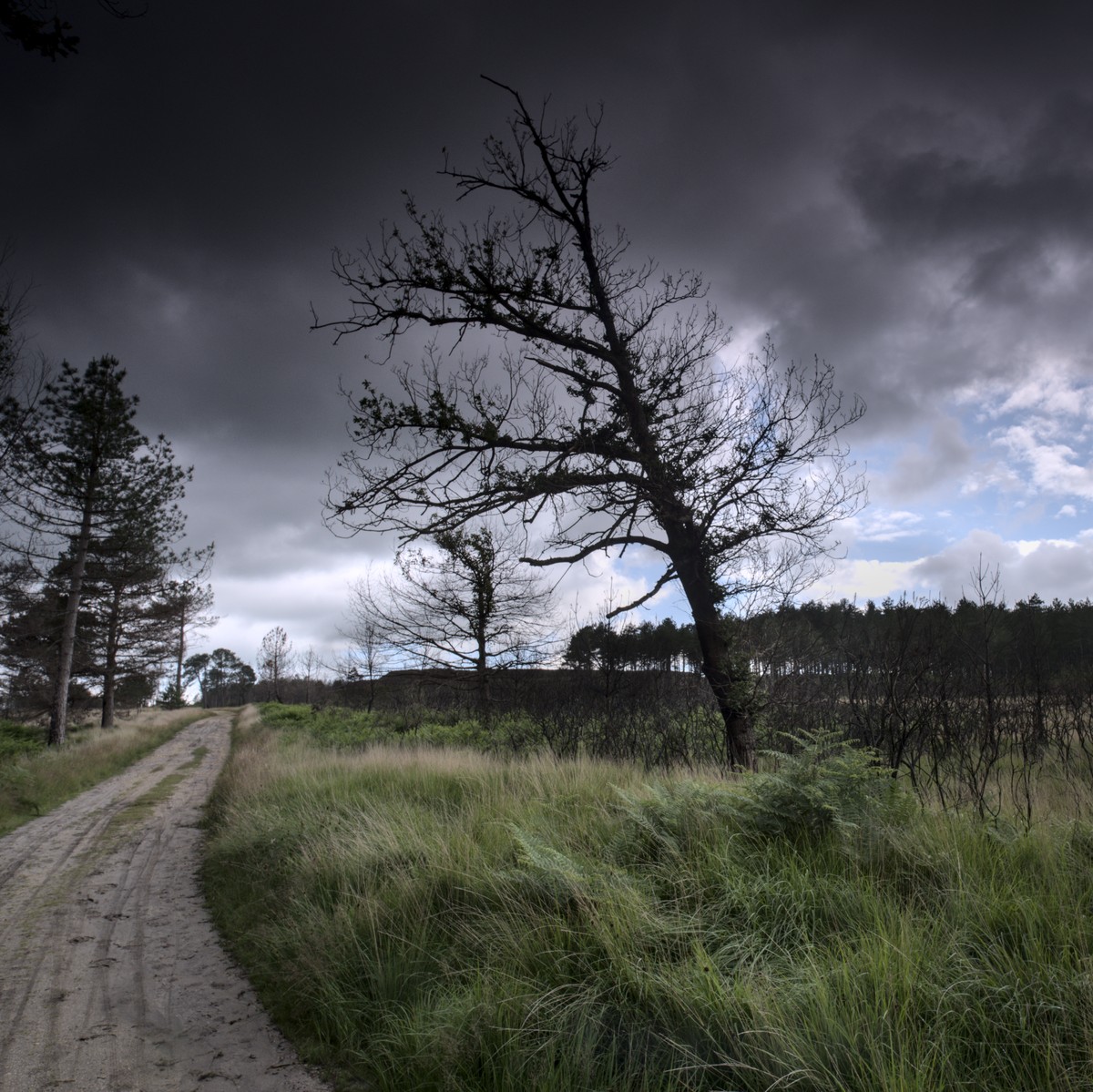
A descent and the sun going in had a long sleeve on for a while in the next run of lanes. I felt like I was getting closer now, though not quite done yet. The next stretch was on forestry tracks through Wareham Forest. The geology changed – from chalky downland to sand and peat. There had been a large fire last year, and there were still sections of burnt trees and open ground. The tracks through the forest wound around, making it hard to keep a sense of direction and certainly giving the impression that this wasn’t the shortest path – though it was when I planned it! It was nice to take in easy though, mixing with mountain bikers out for a blast, families and walkers – one couple taking an interest in my trip as I put on a waterproof for a shower.
Through Wareham, Komoot had me taking alleys through housing, which felt a bit weird and wasn’t always easy to follow. Then some cycle path, other the railway, and a pause to buy some supper before the shops closed.
I picked up another cycle route across the heath, mixing lane and sandy tracks. My chain was now a bit more audible, rain and distance having removed the lubrication. I misjudged the approach to a gate as a lady with a dog held it open but standing in the place I’d normally have ridden to open it myself – and picked up a scratch from my chainring.
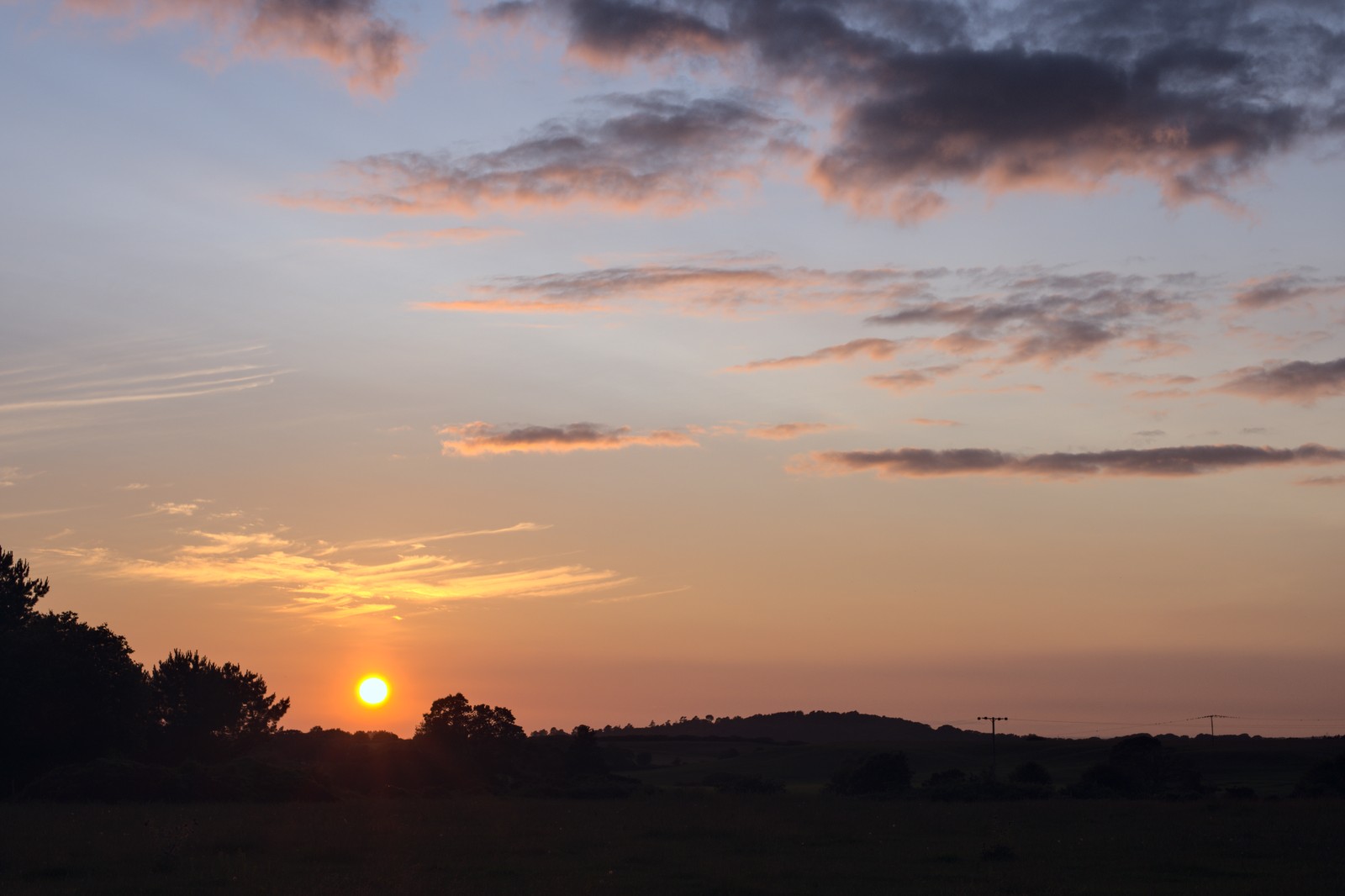
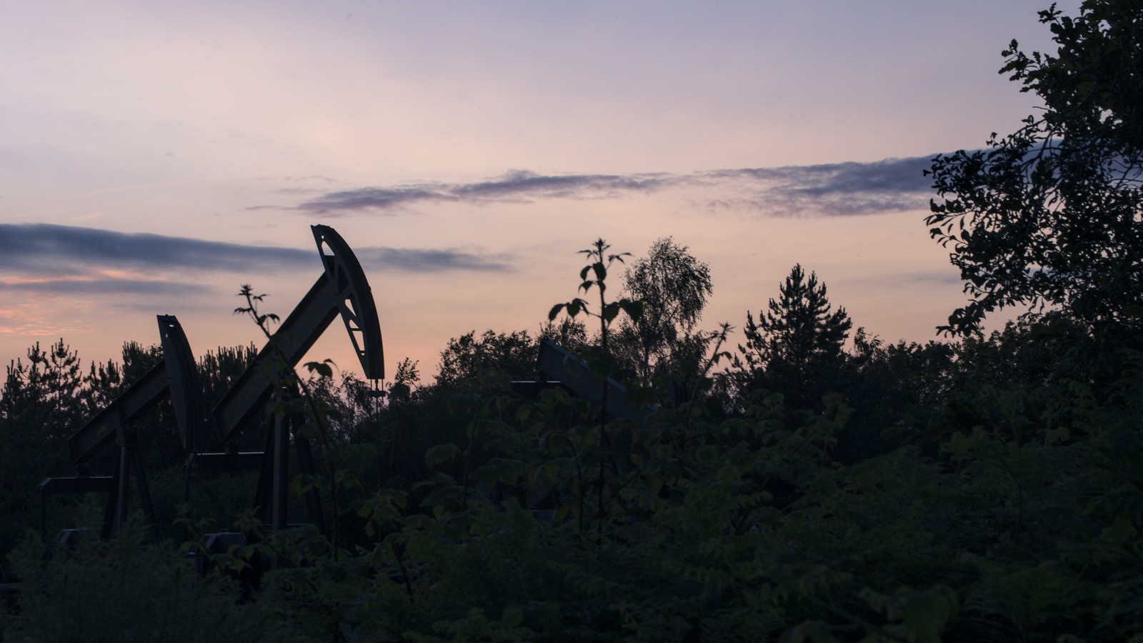
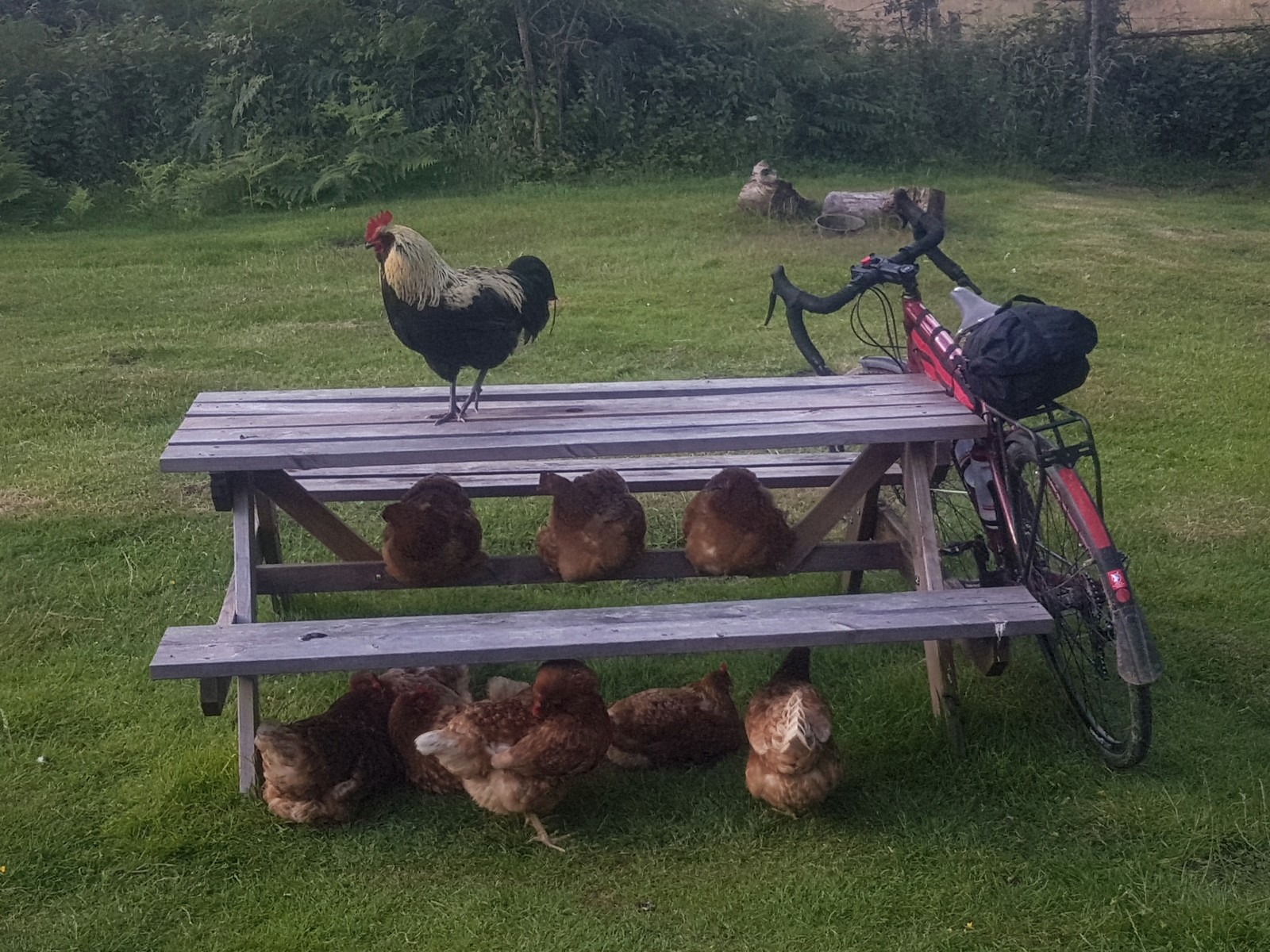
Soon enough I arrived at my “pod”. It was pretty basic – as advertised – more like camping than glamping. There was a compost toilet, a shower in a farm shed, more chickens running about – but also Swallows nesting and many birds in the trees. I took a walk at sunset, saw some nodding donkeys at the local oil works and met no-one (though a party with music was happening by the bay). Not uninhabited, but far from the bustle.
My bed wasn’t the most comfy, but a good day out had me sleeping well all the same. My GPS said I’d covered 100km and 1200m of climb in just under 10 hours – of which just over 7 hours were “moving”. I suspect some of my walking around ancient places and pushing through undergrowth didn’t count as cycling in the mind of the Garmin.
